cropcircles.photos the public record of crop formations, 1590–2026
view

Places · England · 2,005 formations · page 5 of 21

Wiltshire England

2010s

41 formations
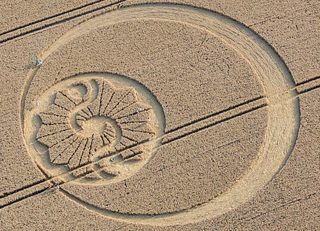
aerial of Stanton Bridge photograph
Olivier MorelStanton Bridge8 August 2010 · EnglandUK20100808_C 8 August 2010 · England photograph · Olivier Morel
aerial of Pewsey photograph
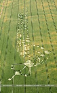
Matthew WilliamsPewsey8 August 2010 · EnglandUK20100808_B 8 August 2010 · England photograph · Matthew Williams
aerial of Yatesbury photograph
Bert JanssenYatesbury6 August 2010 · EnglandUK20100806_B 6 August 2010 · England photograph · Bert Janssen
aerial of Whitefield Hill photograph
Lucy PringleWhitefield Hill3 August 2010 · EnglandUK20100803_D 3 August 2010 · England photograph · Lucy Pringle
aerial of Pewsey photograph
John MontgomeryPewsey3 August 2010 · EnglandUK20100803_C 3 August 2010 · England photograph · John Montgomery
aerial of Lurkeley Hill photograph
John MontgomeryLurkeley Hill3 August 2010 · EnglandUK20100803_B 3 August 2010 · England photograph · John Montgomery
diagram of Alton Barnes drawing
cropcirclecenter.com / Bertold ZugelderAlton Barnes3 August 2010 · EnglandUK20100803_A 3 August 2010 · England drawing · drawn by cropcirclecenter.com / Bertold Zugelder
aerial of Westbury photograph
Bert JanssenWestbury1 August 2010 · EnglandUK20100801_A 1 August 2010 · England photograph · Bert Janssen
diagram of Alton Barnes drawing
cropcirclecenter.com / Bertold ZugelderAlton Barnes31 July 2010 · EnglandUK20100731_A 31 July 2010 · England drawing · drawn by cropcirclecenter.com / Bertold Zugelder
aerial of Alton Barnes photograph
cropcirclecenter.comAlton Barnes29 July 2010 · EnglandUK20100729_A 29 July 2010 · England photograph · cropcirclecenter.com
aerial of Silbury Hill photograph
Steve HabgoodSilbury Hill28 July 2010 · EnglandUK20100728_C 28 July 2010 · England photograph · Steve Habgood
aerial of Milk Hill photograph
Egil FyllingMilk Hill28 July 2010 · EnglandUK20100728_B 28 July 2010 · England photograph · Egil Fylling
other of Beggar's Knoll photograph
Lucy PringleBeggar's Knoll27 July 2010 · United Kingdomx-lp-23caf2985791 27 July 2010 · United Kingdom photograph · Lucy Pringle
aerial of Windmill Hill photograph
John MontgomeryWindmill Hill27 July 2010 · EnglandUK20100727_B 27 July 2010 · England photograph · John Montgomery
aerial of Chalk Pit photograph
John MontgomeryChalk Pit27 July 2010 · EnglandUK20100727_A 27 July 2010 · England photograph · John Montgomery
aerial of Alton Barnes photograph
John MontgomeryAlton Barnes26 July 2010 · EnglandUK20100726_A 26 July 2010 · England photograph · John Montgomery
aerial of Roundway Hill photograph
John MontgomeryRoundway Hill25 July 2010 · EnglandUK20100725_B 25 July 2010 · England photograph · John Montgomery
aerial of Alton Barnes photograph
anonymous – ghost from following yearAlton Barnes25 July 2010 · EnglandUK20100725_A 25 July 2010 · England photograph · anonymous – ghost from following year
aerial of Vernham Dean photograph
Lucy PringleVernham Dean17 July 2010 · EnglandUK20100717_B 17 July 2010 · England photograph · Lucy Pringle
aerial of Cley Hill photograph
Steve AlexanderCley Hill9 July 2010 · EnglandUK20100709_A 9 July 2010 · England photograph · Steve Alexander
aerial of Mere photograph
anonymosMere5 July 2010 · EnglandUK20100705_B 5 July 2010 · England photograph · anonymos
aerial of Chisbury photograph
Steve AlexanderChisbury3 July 2010 · EnglandUK20100703_A 3 July 2010 · England photograph · Steve Alexander
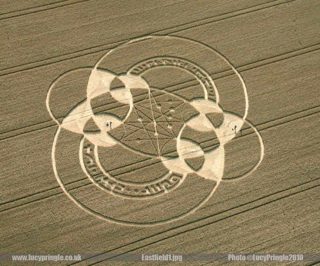
other of East Field 1 photograph
Lucy PringleEast Field 1July 2010 · United Kingdomx-lp-3933d14c5c65 July 2010 · United Kingdom photograph · Lucy Pringle
aerial of Mere photograph
John MontgomeryMere25 June 2010 · EnglandUK20100625_A 25 June 2010 · England photograph · John Montgomery
aerial of Savernake Forest photograph
Olivier MorelSavernake Forest23 June 2010 · EnglandUK20100623_A 23 June 2010 · England photograph · Olivier Morel
aerial of Oare photograph
Olivier MorelOare21 June 2010 · EnglandUK20100621_A 21 June 2010 · England photograph · Olivier Morel
aerial of Chirton Bottom photograph
Olivier MorelChirton Bottom16 June 2010 · EnglandUK20100616_A 16 June 2010 · England photograph · Olivier Morel
other of St Martin's Chapel nr Chisbury photograph
Lucy PringleSt Martin's Chapel nr Chisbury3 June 2010 · United Kingdomx-lp-e449ec75751f 3 June 2010 · United Kingdom photograph · Lucy Pringle
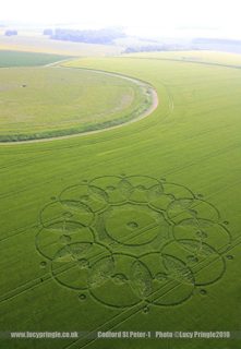
other of Codford St Peter photograph
Lucy PringleCodford St Peter3 June 2010 · United Kingdomx-lp-1b51b32b5abe 3 June 2010 · United Kingdom photograph · Lucy Pringle
aerial of Codford St Peter photograph
Chris RichardsonCodford St Peter3 June 2010 · EnglandUK20100603_A 3 June 2010 · England photograph · Chris Richardson
aerial of Liddington Castle photograph
anonymosLiddington Castle2 June 2010 · EnglandUK20100602_A 2 June 2010 · England photograph · anonymos
other of West Woods photograph
Lucy PringleWest Woods31 May 2010 · United Kingdomx-lp-86cf214e483a 31 May 2010 · United Kingdom photograph · Lucy Pringle
aerial of Westwoods photograph
Olivier MorelWestwoods31 May 2010 · EnglandUK20100531_B 31 May 2010 · England photograph · Olivier Morel
aerial of Silbury Hill photograph
Lucy PringleSilbury Hill31 May 2010 · EnglandUK20100531_A 31 May 2010 · England photograph · Lucy Pringle
aerial of Yatesbury photograph
Andrew PyrkaYatesbury27 May 2010 · EnglandUK20100527_A 27 May 2010 · England photograph · Andrew Pyrka
aerial of Wilton photograph
Lucy PringleWilton22 May 2010 · EnglandUK20100522_A 22 May 2010 · England photograph · Lucy Pringle
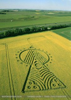
other of Yarnbury Castle photograph
Lucy PringleYarnbury Castle16 May 2010 · United Kingdomx-lp-f7506b231511 16 May 2010 · United Kingdom photograph · Lucy Pringle
aerial of Yarnbury Castle photograph
Steve AlexanderYarnbury Castle16 May 2010 · EnglandUK20100516_B 16 May 2010 · England photograph · Steve Alexander
aerial of Yarnbury Castle photograph
Steve AlexanderYarnbury Castle16 May 2010 · EnglandUK20100516_A 16 May 2010 · England photograph · Steve Alexander
aerial of Stonehenge photograph
Lucy PringleStonehenge9 May 2010 · EnglandUK20100509_A 9 May 2010 · England photograph · Lucy Pringle
aerial of Old Sarum photograph
Lucy PringleOld Sarum5 May 2010 · EnglandUK20100505_A 5 May 2010 · England photograph · Lucy Pringle

2000s

55 formations
aerial of Tidcombe photograph
Olivier MorelTidcombe16 August 2009 · EnglandUK20090816_A 16 August 2009 · England photograph · Olivier Morel
aerial of Woodborough Hill photograph
Lucy PringleWoodborough Hill10 August 2009 · EnglandUK20090810_A 10 August 2009 · England photograph · Lucy Pringle
aerial of BIshop Sutton photograph
Lucy PringleBIshop Sutton9 August 2009 · EnglandUK20090809_A 9 August 2009 · England photograph · Lucy Pringle
aerial of West Overton photograph
Steve AlexanderWest Overton8 August 2009 · EnglandUK20090808_C 8 August 2009 · England photograph · Steve Alexander
aerial of Alton Priors photograph
Russel StannardAlton Priors8 August 2009 · EnglandUK20090808_B 8 August 2009 · England photograph · Russel Stannard
aerial of Alton Priors photograph
Russel StannardAlton Priors8 August 2009 · EnglandUK20090808_A 8 August 2009 · England photograph · Russel Stannard
aerial of Yatesbury photograph
Lucy PringleYatesbury6 August 2009 · EnglandUK20090806_B 6 August 2009 · England photograph · Lucy Pringle
aerial of Windmill Hill photograph
Lucy PringleWindmill Hill6 August 2009 · EnglandUK20090806_A 6 August 2009 · England photograph · Lucy Pringle
aerial of Silbury Hill photograph
Olivier MorelSilbury Hill3 August 2009 · EnglandUK20090803_C 3 August 2009 · England photograph · Olivier Morel
aerial of Morgans Hill photograph
Lucy PringleMorgans Hill2 August 2009 · EnglandUK20090802_B 2 August 2009 · England photograph · Lucy Pringle
aerial of Alton Priors photograph
Russel StannardAlton Priors2 August 2009 · EnglandUK20090802_A 2 August 2009 · England photograph · Russel Stannard
aerial of Winterbourne Bassett photograph
Lucy PringleWinterbourne Bassett31 July 2009 · EnglandUK20090731_C 31 July 2009 · England photograph · Lucy Pringle
aerial of Waden Hill photograph
cropcirclecenter.comWaden Hill31 July 2009 · EnglandUK20090731_B 31 July 2009 · England photograph · cropcirclecenter.com
aerial of Hackpen Hill photograph
Olivier MorelHackpen Hill31 July 2009 · EnglandUK20090731_A 31 July 2009 · England photograph · Olivier Morel
aerial of Ogbourne St Andrew photograph
Lucy PringleOgbourne St Andrew29 July 2009 · EnglandUK20090729_A 29 July 2009 · England photograph · Lucy Pringle
aerial of Winterbourne Bassett photograph
Lucy PringleWinterbourne Bassett28 July 2009 · EnglandUK20090728_A 28 July 2009 · England photograph · Lucy Pringle
diagram of Tawesmead Copse drawing
cropcirclecenter.com / Bertold ZugelderTawesmead Copse25 July 2009 · EnglandUK20090725_B 25 July 2009 · England drawing · drawn by cropcirclecenter.com / Bertold Zugelder
aerial of Alton Priors photograph
Russel StannardAlton Priors25 July 2009 · EnglandUK20090725_A 25 July 2009 · England photograph · Russel Stannard
aerial of Ogbourne Down photograph
Lucy PringleOgbourne Down24 July 2009 · EnglandUK20090724_A 24 July 2009 · England photograph · Lucy Pringle
aerial of Woodborough Hill photograph
Lucy PringleWoodborough Hill22 July 2009 · EnglandUK20090722_A 22 July 2009 · England photograph · Lucy Pringle
aerial of Martinsell Hill photograph
Steve AlexanderMartinsell Hill19 July 2009 · EnglandUK20090719_B 19 July 2009 · England photograph · Steve Alexander
aerial of Liddington Castle photograph
Lucy PringleLiddington Castle19 July 2009 · EnglandUK20090719_A 19 July 2009 · England photograph · Lucy Pringle
aerial of Grey Wethers photograph
Lucy PringleGrey Wethers14 July 2009 · EnglandUK20090714_B 14 July 2009 · England photograph · Lucy Pringle
aerial of Alton Barnes photograph
Lucy PringleAlton Barnes14 July 2009 · EnglandUK20090714_A 14 July 2009 · England photograph · Lucy Pringle
diagram of All Cannings drawing
cropcirclecenter.com / Bertold ZugelderAll Cannings13 July 2009 · EnglandUK20090713_A 13 July 2009 · England drawing · drawn by cropcirclecenter.com / Bertold Zugelder
aerial of All Cannings photograph
Steve AlexanderAll Cannings10 July 2009 · EnglandUK20090710_A 10 July 2009 · England photograph · Steve Alexander
diagram of Stanton St Bernard drawing
cropcirclecenter.com / Bertold ZugelderStanton St Bernard9 July 2009 · EnglandUK20090709_C 9 July 2009 · England drawing · drawn by cropcirclecenter.com / Bertold Zugelder
aerial of Yatesbury photograph
Lucy PringleYatesbury8 July 2009 · EnglandUK20090708_A 8 July 2009 · England photograph · Lucy Pringle
aerial of Clatford photograph
Steve AlexanderClatford7 July 2009 · EnglandUK20090707_A 7 July 2009 · England photograph · Steve Alexander
other of Honey St photograph
Lucy PringleHoney St6 July 2009 · United Kingdomx-lp-bf96c3194fc3 6 July 2009 · United Kingdom photograph · Lucy Pringle
diagram of Honeystreet drawing
cropcirclecenter.com / Bertold ZugelderHoneystreet6 July 2009 · EnglandUK20090706_A 6 July 2009 · England drawing · drawn by cropcirclecenter.com / Bertold Zugelder
aerial of Stanton St Bernard photograph
Lucy PringleStanton St Bernard5 July 2009 · EnglandUK20090705_C 5 July 2009 · England photograph · Lucy Pringle
aerial of Silbury Hill photograph
Lucy PringleSilbury Hill5 July 2009 · EnglandUK20090705_B 5 July 2009 · England photograph · Lucy Pringle
aerial of Devizes photograph
Jack RoderickDevizes5 July 2009 · EnglandUK20090705_A 5 July 2009 · England photograph · Jack Roderick
aerial of Pewsey photograph
Charles R. MallettPewsey4 July 2009 · EnglandUK20090704_B 4 July 2009 · England photograph · Charles R. Mallett
aerial of Beckhampton photograph
John MontgomeryBeckhampton4 July 2009 · EnglandUK20090704_A 4 July 2009 · England photograph · John Montgomery
diagram of Waden Hill drawing
cropcirclecenter.com / Bertold ZugelderWaden Hill3 July 2009 · EnglandUK20090703_A 3 July 2009 · England drawing · drawn by cropcirclecenter.com / Bertold Zugelder
aerial of Milk Hill photograph
John MontgomeryMilk Hill2 July 2009 · EnglandUK20090702_A 2 July 2009 · England photograph · John Montgomery
other of Smeathes Plantation photograph
Lucy PringleSmeathes PlantationJuly 2009 · United Kingdomx-lp-dda116980a57 July 2009 · United Kingdom photograph · Lucy Pringle
other of Yatesbury photograph
Lucy PringleYatesburyJuly 2009 · United Kingdomx-lp-0a2d982e9287 July 2009 · United Kingdom photograph · Lucy Pringle
aerial of Waden Hill photograph
Lucy PringleWaden Hill1 July 2009 · EnglandUK20090701_A 1 July 2009 · England photograph · Lucy Pringle
other of Milk Hill Addition (3) photograph
Lucy PringleMilk Hill Addition (3)30 June 2009 · United Kingdomx-lp-96f7eb5a64f4 30 June 2009 · United Kingdom photograph · Lucy Pringle
other of Knoll Down (2) photograph
Lucy PringleKnoll Down (2)28 June 2009 · United Kingdomx-lp-b2845f67326b 28 June 2009 · United Kingdom photograph · Lucy Pringle
aerial of Pewsey White Horse photograph
Lucy PringlePewsey White Horse28 June 2009 · EnglandUK20090628_D 28 June 2009 · England photograph · Lucy Pringle
diagram of Milk Hill drawing
cropcirclecenter.com / Bertold ZugelderMilk Hill28 June 2009 · EnglandUK20090628_C 28 June 2009 · England drawing · drawn by cropcirclecenter.com / Bertold Zugelder
aerial of Beckhampton photograph
Charles R. MallettBeckhampton28 June 2009 · EnglandUK20090628_B 28 June 2009 · England photograph · Charles R. Mallett
aerial of Beckhampton photograph
Steve AlexanderBeckhampton28 June 2009 · EnglandUK20090628_A 28 June 2009 · England photograph · Steve Alexander
aerial of Milk Hill photograph
John MontgomeryMilk Hill27 June 2009 · EnglandUK20090627_C 27 June 2009 · England photograph · John Montgomery
aerial of Honeystreet photograph
Jack RoderickHoneystreet27 June 2009 · EnglandUK20090627_B 27 June 2009 · England photograph · Jack Roderick
aerial of Alton Priors photograph
John MontgomeryAlton Priors27 June 2009 · EnglandUK20090627_A 27 June 2009 · England photograph · John Montgomery
aerial of Martinsell Hill photograph
John MontgomeryMartinsell Hill25 June 2009 · EnglandUK20090625_A 25 June 2009 · England photograph · John Montgomery
aerial of Winterbourne Bassett photograph
Russel StannardWinterbourne Bassett24 June 2009 · EnglandUK20090624_A 24 June 2009 · England photograph · Russel Stannard
aerial of Milk Hill photograph
Lucy PringleMilk Hill23 June 2009 · EnglandUK20090623_A 23 June 2009 · England photograph · Lucy Pringle
diagram of Milk Hill drawing
cropcirclecenter.com / Bertold ZugelderMilk Hill22 June 2009 · EnglandUK20090622_A 22 June 2009 · England drawing · drawn by cropcirclecenter.com / Bertold Zugelder
other of East Kennet photograph
Lucy PringleEast Kennet21 June 2009 · United Kingdomx-lp-461bf7e5ff04 21 June 2009 · United Kingdom photograph · Lucy Pringle