East Kennett
UK20160827_B27 August 2016·East Kennett, Wiltshire·wheat
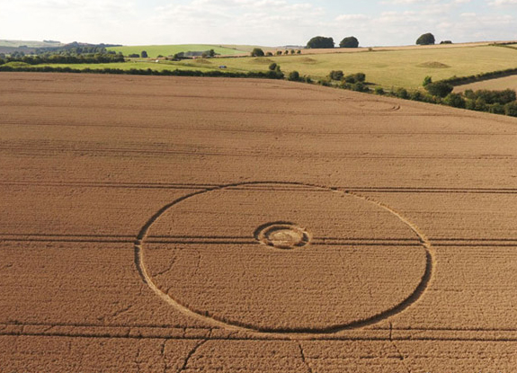
Reported 27 August 2016 in wheat at East Kennett, Wiltshire. Three archives recorded it, and they give the same date.
The record
- date
- 27 August 2016 (day precision)
- place
- East Kennett
Wiltshire
England - crop
- wheat
- size
- 120 ft (36.6 m) across
- recorded by
- cc ccc tt
- images
- 18 on the record, 1 attached · 2 diagram, 13 aerial, 3 other
- writing
- 1 document(s)
Also called
Overton Hill Overton Hill, wilts nr East Kennett
Canonical name from the cropcirclecenter.com name; the rest are what the other source records print for the same formation.
Where exactly
- coordinate
- 51.411344, -1.826693
- how it was got
- grid ref
exact, to within 50 m, from the ccc record - grid reference
- SU121680
- on a map
- OpenStreetMap · the source's own link
No source publishes a coordinate for any formation in this archive. Every coordinate here is derived from the place name a source printed, and this page says how precise that makes it rather than rounding it away.
Images
18 image(s) on this formation's own source records, and 1 more on 1 attached record(s) below. Click a tile for the full image; the bytes are fetched when you ask for them and are not stored in this page.
Diagrams (2)
 diagram
cropcirclecenter.com / Bertold Zugelder site default
diagram
cropcirclecenter.com / Bertold Zugelder site default
diagram
cropcirclecenter.com / Bertold Zugelder site default
diagram
cropcirclecenter.com / Bertold Zugelder site default
| site | kind | credit | basis | caption | size | file | source page |
|---|---|---|---|---|---|---|---|
| cc | diagram | cropcirclecenter.com / Bertold Zugelder | site default | crop circle at East Kennett | August 27 2016 | 575×415 44.8 KiB image/jpeg |
image 4ada7532b3a0 | https://www.cropcirclecenter.com/ccdata/2016/08/27/UK20160827_B.html |
| cc | diagram | cropcirclecenter.com / Bertold Zugelder | site default | crop circle at East Kennett | August 27 2016 | 575×415 44.8 KiB image/jpeg |
image 4ada7532b3a0 | https://www.cropcirclecenter.com/date/2016/201608.html |
Photographs (13)
 aerial
cropcircleconnector.com image credit
aerial
cropcircleconnector.com image credit
 aerial
MegalithomaniaUK image-group credit
aerial
MegalithomaniaUK image-group credit
 aerial
MegalithomaniaUK image-group credit
aerial
MegalithomaniaUK image-group credit
 aerial
MegalithomaniaUK image-group credit
aerial
MegalithomaniaUK image-group credit
 aerial
cropcircleconnector.com no credit recorded
aerial
cropcircleconnector.com no credit recorded
 aerial
cropcircleconnector.com no credit recorded
aerial
cropcircleconnector.com no credit recorded
 aerial
cropcircleconnector.com no credit recorded
aerial
cropcircleconnector.com no credit recorded
 aerial
cropcircleconnector.com no credit recorded
aerial
cropcircleconnector.com no credit recorded
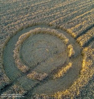 aerial
cropcircleconnector.com no credit recorded
aerial
cropcircleconnector.com no credit recorded
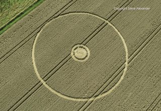 aerial
Steve Alexander / Temporary Temples site default
aerial
Steve Alexander / Temporary Temples site default
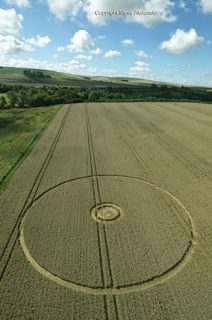 aerial
Steve Alexander / Temporary Temples site default
aerial
Steve Alexander / Temporary Temples site default
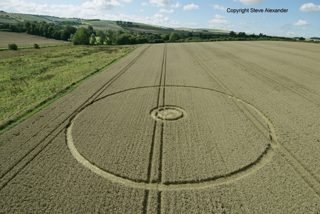 aerial
Steve Alexander / Temporary Temples site default
aerial
Steve Alexander / Temporary Temples site default
 aerial
Steve Alexander / Temporary Temples site default
aerial
Steve Alexander / Temporary Temples site default
| site | kind | credit | basis | caption | size | file | source page |
|---|---|---|---|---|---|---|---|
| cc | aerial | cropcircleconnector.com | image credit | crop circle at East Kennett | August 27 2016 | 575×415 197.9 KiB image/jpeg |
image ca24beefac71 | https://www.cropcirclecenter.com/ccdata/2016/08/27/UK20160827_B.html |
| ccc | aerial | MegalithomaniaUK | image-group credit | 800×450 211.4 KiB image/jpeg |
image d5da9d44cedc | https://www.cropcircleconnector.com/2016/overton/overton2016a.html | |
| ccc | aerial | MegalithomaniaUK | image-group credit | 800×450 122.3 KiB image/jpeg |
image 472bd088a9d1 | https://www.cropcircleconnector.com/2016/overton/overton2016a.html | |
| ccc | aerial | MegalithomaniaUK | image-group credit | 800×450 138.9 KiB image/jpeg |
image 2146b7abec7b | https://www.cropcircleconnector.com/2016/overton/overton2016a.html | |
| ccc | aerial | cropcircleconnector.com | no credit recorded | 800×437 117.0 KiB image/jpeg |
image e7abe82abaa2 | https://www.cropcircleconnector.com/2016/overton/overton2016a.html | |
| ccc | aerial | cropcircleconnector.com | no credit recorded | 800×600 155.3 KiB image/jpeg |
image f6e21c5e5190 | https://www.cropcircleconnector.com/2016/overton/overton2016a.html | |
| ccc | aerial | cropcircleconnector.com | no credit recorded | 800×885 339.0 KiB image/jpeg |
image 58e752e50db3 | https://www.cropcircleconnector.com/2016/overton/overton2016a.html | |
| ccc | aerial | cropcircleconnector.com | no credit recorded | 800×444 181.0 KiB image/jpeg |
image edc5c90c2d26 | https://www.cropcircleconnector.com/2016/overton/overton2016a.html | |
| ccc | aerial | cropcircleconnector.com | no credit recorded | 800×849 375.9 KiB image/jpeg |
image 233d00373a24 | https://www.cropcircleconnector.com/2016/overton/overton2016a.html | |
| tt | aerial | Steve Alexander / Temporary Temples | site default | Overton Hill, nr East Kennett, Wilts | 27th August 2016 | Wheat OH | 800×553 645.9 KiB image/jpeg |
image b0b75def24f0 | https://temporarytemples.co.uk/project/overton-hill-wilts-27th-august-2016 |
| tt | aerial | Steve Alexander / Temporary Temples | site default | Overton Hill, nr East Kennett, Wilts | 27th August 2016 | Wheat L | 529×800 464.1 KiB image/jpeg |
image d4bb56b15d25 | https://temporarytemples.co.uk/project/overton-hill-wilts-27th-august-2016 |
| tt | aerial | Steve Alexander / Temporary Temples | site default | Overton Hill, nr East Kennett, Wilts | 27th August 2016 | Wheat L3 | 800×534 484.9 KiB image/jpeg |
image 1838a13a4f3b | https://temporarytemples.co.uk/project/overton-hill-wilts-27th-august-2016 |
| tt | aerial | Steve Alexander / Temporary Temples | site default | Overton Hill, nr East Kennett, Wilts | 27th August 2016 | Wheat L2 | 800×534 538.4 KiB image/jpeg |
image 4429a56ba96b | https://temporarytemples.co.uk/project/overton-hill-wilts-27th-august-2016 |
Other images (3)
 other
cropcircleconnector.com no credit recorded
other
cropcircleconnector.com no credit recorded
 other
cropcircleconnector.com no credit recorded
other
cropcircleconnector.com no credit recorded
 other
Steve Alexander / Temporary Temples site default
other
Steve Alexander / Temporary Temples site default
| site | kind | credit | basis | caption | size | file | source page |
|---|---|---|---|---|---|---|---|
| ccc | other | cropcircleconnector.com | no credit recorded | 600×393 322.0 KiB image/jpeg |
image 6bea24946964 | https://www.cropcircleconnector.com/2016/overton/comments.html | |
| ccc | other | cropcircleconnector.com | no credit recorded | 600×416 310.8 KiB image/jpeg |
image d477c471c978 | https://www.cropcircleconnector.com/2016/overton/comments.html | |
| tt | other | Steve Alexander / Temporary Temples | site default | Wiltshire Landscape Overview | 800×505 327.0 KiB image/jpeg |
image 75eeb57621ee | https://temporarytemples.co.uk/project/overton-hill-wilts-27th-august-2016 |
Attached photographs (1)
inferred link These pictures did not come with a source record of this formation. Each one is a single-photograph archive entry whose own date and place the index matched to this formation; nothing about the formation itself comes from them. The rule, the score and the evidence are printed with each record so the link can be checked, and the credit stays with the photograph.
Overton Hill, wilts | 27th August 2016
tt temporarytemples.co.uk · archive_image · 27 August 2016 ·
matched on date and place by the index (not confirmed by hand) · rule attach, tier B, score 0.90 ·
pair 2df5c12aa87e · decided 2026-09-15T03:03:25Z
- attachment: tt archive_image overton-hill-wilts-27th-august-2016
- date 2016-08-27 vs 2016-08-27 (delta +0 d)
- name tokens shared: overton
- county Wiltshire == Wiltshire
- country UK (uk_county) == UK (uk_county)
- the only entity the photograph's date and place fit (UK20160827_B)
| site | kind | credit | basis | caption | size | file | source page |
|---|---|---|---|---|---|---|---|
| tt | aerial | Steve Alexander / Temporary Temples | site default | Overton Hill, wilts | 27th August 2016 | 800×553 645.9 KiB image/jpeg |
image b0b75def24f0 | https://temporarytemples.co.uk/crop-circles/2016-crop-circles-2 |
Date
27 August 2016, to day precision. What a source records is the day a formation was found and reported.
- reported by
- cc: 27 August 2016 ccc: 27 August 2016 tt: 27 August 2016
- weekday
- Saturday, day 240 of the year, ISO week 34, summer
- sun and moon
- 26.1 days before the September equinox; moon waning crescent (25% lit), 9.1 days after the full moon (computed at 12:00 UTC; a reported date is a discovery date, not a creation date)
Place
What each source printed, and the coordinate derived from it. No source in this archive publishes a coordinate of its own.
- coordinate
- 51.411344, -1.826693 — exact, ±50 m, by grid_ref, from the ccc record
- on a map
- OpenStreetMap
| site | place | county | country | grid ref | what3words | fix |
|---|---|---|---|---|---|---|
| cc | Wiltshire | England | 51.405503, -1.829418 place / os_open_names | |||
| ccc | nr East Kennett | Wiltshire | SU121680 | 51.411344, -1.826693 exact / grid_ref | ||
| tt | Overton Hill | Wiltshire | 51.437569, -1.812869 place / os_open_names |
The source's own map link: http://www.streetmap.co.uk/map.srf?x=412189&y=168004&z=0&sv=51.410936,+-1.826124&st=7&mapp=map.srf&searchp=ids.srf
Crop and size
- crop
- wheat (cc: wheat, ccc: —, tt: wheat)
- diameter
- 120 ft (36.6 m)
- size as written
- not recorded
Source records
What each source published, side by side. A row whose values differ across the sources is marked: the archive prints the disagreement rather than choosing a winner.
| field | cc cropcirclecenter.com | ccc cropcircleconnector.com | tt temporarytemples.co.uk |
|---|---|---|---|
| id / slug differs | UK20160827_B | overton | overton-hill-wilts-27th-august-2016 |
| name differs | East Kennett | Overton Hill | Overton Hill, wilts |
| location differs | nr East Kennett | Overton Hill | |
| county | Wiltshire | Wiltshire | Wiltshire |
| country | England | ||
| date reported | 2016-08-27 | 2016-08-27 | 2016-08-27 |
| date precision | day | day | day |
| crop | wheat | wheat | |
| size | |||
| diameter (ft) | 120 | ||
| grid reference | SU121680 | ||
| what3words | |||
| map link | http://www.streetmap.co.uk/map.srf?x=412189&y=168004&z=0&sv=51.410936,+-1.826124&st=7&mapp=map.srf&searchp=ids.srf | ||
| credits differs | cropcirclecenter.com / Bertold Zugelder, cropcircleconnector.com | Crop Circle Photo Box-Set, Steve Alexander / Temporary Temples | |
| source page differs | https://www.cropcirclecenter.com/date/2016/201608.html | https://www.cropcircleconnector.com/2016/overton/overton2016a.html | https://temporarytemples.co.uk/project/overton-hill-wilts-27th-august-2016 |
| link to the entity | rule Cscore 0.60 decided by review on 2026-09-11 date 2016-08-27 vs 2016-08-27 (delta +0 d); county Wiltshire == Wiltshire; country UK (cc_id) == UK (uk_county); review: accept (cc East Kennett = CCC Overton Hill nr East Kennett (tier B) = TT Overton Hill, 27 Aug 2016) at 2026-09-11T19:50:05Z |
rule Bscore 0.90 decided by rule on 2026-09-11 date 2016-08-27 vs 2016-08-27 (delta +0 d); place tokens shared: east, kennett; county Wiltshire == Wiltshire; country UK (cc_id) == UK (uk_county) |
rule Cscore 0.60 decided by review on 2026-09-11 date 2016-08-27 vs 2016-08-27 (delta +0 d); county Wiltshire == Wiltshire; country UK (cc_id) == UK (uk_county); review: accept (cc East Kennett = CCC Overton Hill nr East Kennett (tier B) = TT Overton Hill, 27 Aug 2016) at 2026-09-11T19:50:05Z |
| warnings | none | none | narrative had no 'General Information:' terminator |
| record | cc/e0de252f0f356… raw record view: /formation/cc/e0de252f0f356e39efbd5906caaaa1666ca46f8f2867d68f7d2c389b62c0eb54 in the preview app |
ccc/5438a4ac3ad8… raw record view: /formation/ccc/5438a4ac3ad81c467cae93d925d9cec4f2e866f026c12f06d783875fcfa0c538 in the preview app |
tt/588633e668360… raw record view: /formation/tt/588633e668360b629cfe83b5bbe85686e7b20db83aec17a8c6aba1ecccea4527 in the preview app |
Texts
1 document(s), each attached to the record whose page hosts it. These are other people's words: quoted here in short attributed extract, with a link to the page that published each one in full.
Overton Hill, nr East Kennett, Wiltshire narrative · tt
author: Temporary Temples (site default) · date: 27 August 2016 (record) · language: en· 530 characters · source page
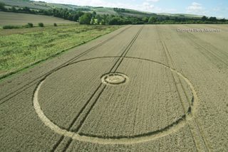
This was to be last circle we recorded from the 2016 season and with it concludes our coverage of the season, which is now at and end.
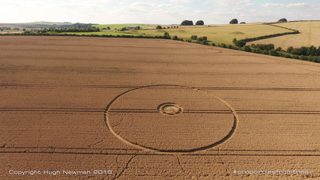
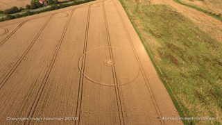
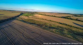
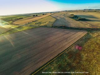
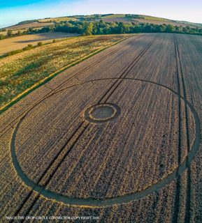
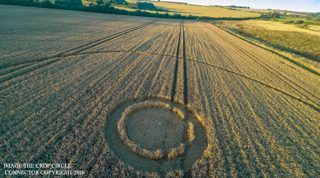
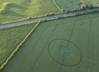
This double ringed circle could just be the last of the 2016 season, measuring approximately 120ft is was placed towards the side of a wheat field on Overton Hill, while many often talk of a grand finale, it is more often the case that the final circles of the season are smaller more simpler designs; the beginning of the season which starts slowly, like the end, seems to ebb to a conclusion.
Claims about this formation
no claim was extracted from a text about this formation
Geometry
2 diagram file(s) on this page. measured from the diagram itself, and experimental: the extractor's rotational order is right on 88.8 % of a 200-diagram hand-labelled set against a gate of 90 %, so read a number here beside the picture rather than instead of it.
| diagram | rotational symmetry | elements | rings | mirror | fill |
|---|---|---|---|---|---|
| cc 4ada7532 | ≈ continuous (concentric circles) | 3 | 3 | 0.995 | 0.1234 |
Experimental, and marked ≈ wherever it appears. These numbers are read off a drawing, not off the field: the extractor's rotational order agrees with a hand-labelled set on 88.8 per cent of 200 diagrams against a gate of 90 per cent, its element count is within one on 97.5 per cent, and its ring count is not calibrated at all. Nothing in the analysis tree is derived from the rotational order while that gate is unmet.
Diagrams that look like these: cc 4ada7532— the nearest by perceptual hash. The whole archive is browsable by shape in the shape section, and this formation's own diagrams go straight into that grid: show them in the grid.
Neighbours
In time
- previous
- Woodway Bridge 24 August 2016, Woodway Bridge
- next
- Sutton Hall 29 August 2016, Sutton Hall
- previous in UK
- Woodway Bridge 24 August 2016
- next in UK
- Sutton Hall 29 August 2016
- same day
- Beckhamtpon (Beckhamtpon)
- within 7 days and 25 km
- Beckhamtpon 27 August 2016, 5.0 km away, 0 day(s) apart · Woodway Bridge 24 August 2016, 7.7 km away, 3 day(s) apart
In place
The nearest formations the archive can place.
 Avebury3 June 2017
Avebury
145 m away, 2017-06-03
 East Kennett1988
East Kennett
676 m away, 1988
 East Kennett9 August 1989
East Kennett
676 m away, 1989-08-09
 East Kennett27 July 1990
East Kennett
676 m away, 1990-07-27
 East Kennett23 July 1991
East Kennett
676 m away, 1991-07-23
 East KennettJuly 1991
East Kennett
676 m away, 1991-07
- same county and year
- Hill Barn 6 May 2016 · Alton Barnes 11 May 2016 · Avebury 16 May 2016 · Silbury Hill 28 May 2016 · Willoughboy Hedge 5 June 2016 · Castle Hill 6 June 2016 · Wylye 16 June 2016 · Hackpen Hill 23 June 2016 · Stourton 29 June 2016 · Stanton Bridge 8 July 2016 · Stonehenge 7 July 2016 · West Kennett 8 July 2016 · Wilton Windmill 15 July 2016 · Devizes 16 July 2016 · Hackpen Hill 16 July 2016 · Burderop Down 20 July 2016 · Alton Barnes 22 July 2016 · Figsbury Rings 22 July 2016 · Ranscomb Bottom 23 July 2016 · All Cannings 22 July 2016 and 8 more
Provenance
- entity built at
- 2026-09-15T03:03:25Z (derived from the link decisions, not from this build)
- index run ids
- 20260911T192039Z-index-build, 20260915T030325Z-index-build
- reviews applied
- 66c9f842cda1bb3a60415fe1513846a2daa804a1dc24167c674ece9d97f176bf
- open queue pairs
- none
- entity record
- index/formations/UK20160827_B.json · row in index/manifest.jsonl
- input digests
- entity ce5c52e34717 · images 9743fa7e3b34 · attachments 441661328658 · texts 36e9a1fa7014 · geo 5c0ee294b71b