West Kennett
UK20160708_C8 July 2016·West Kennett, Wiltshire·wheat
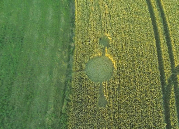
Reported 8 July 2016 in wheat at West Kennett, Wiltshire. Two archives recorded it, and they give the same date.
The record
- date
- 8 July 2016 (day precision)
- place
- West Kennett
Wiltshire
England - crop
- wheat
- size
- not recorded
- recorded by
- cc ccc
- images
- 7 · 2 diagram, 4 aerial, 1 other
- writing
- 2 document(s)
Also called
West Kennett Longbarrow Nr Avebury
Canonical name from the cropcirclecenter.com name; the rest are what the other source records print for the same formation.
Where exactly
- coordinate
- 51.408680, -1.851144
- how it was got
- grid ref
exact, to within 50 m, from the ccc record - grid reference
- SU104677
- on a map
- OpenStreetMap · the source's own link
No source publishes a coordinate for any formation in this archive. Every coordinate here is derived from the place name a source printed, and this page says how precise that makes it rather than rounding it away.
Images
7 image(s) on this formation's own source records. Click a tile for the full image; the bytes are fetched when you ask for them and are not stored in this page.
Diagrams (2)
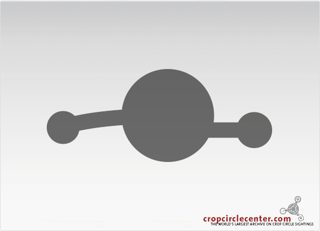 diagram
cropcirclecenter.com / Bertold Zugelder site default
diagram
cropcirclecenter.com / Bertold Zugelder site default
diagram
cropcirclecenter.com / Bertold Zugelder site default
diagram
cropcirclecenter.com / Bertold Zugelder site default
| site | kind | credit | basis | caption | size | file | source page |
|---|---|---|---|---|---|---|---|
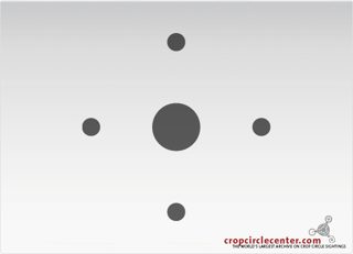
| cc | diagram | cropcirclecenter.com / Bertold Zugelder | site default | crop circle at West Kennett | July 8 2016 | 575×415 36.8 KiB image/jpeg |
image 5dba499e49f7 | https://www.cropcirclecenter.com/ccdata/2016/07/08/UK20160708_C.html |
| cc | diagram | cropcirclecenter.com / Bertold Zugelder | site default | crop circle at West Kennett | July 8 2016 | 575×415 36.8 KiB image/jpeg |
image 5dba499e49f7 | https://www.cropcirclecenter.com/date/2016/201607.html |
Photographs (4)
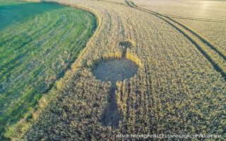
 aerial
cropcircleconnector.com image credit
aerial
cropcircleconnector.com image credit
 aerial
cropcircleconnector.com no credit recorded
aerial
cropcircleconnector.com no credit recorded
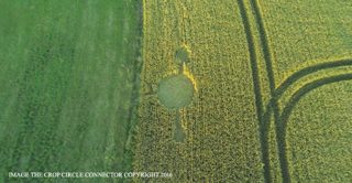 aerial
cropcircleconnector.com no credit recorded
aerial
cropcircleconnector.com no credit recorded
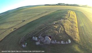 aerial
cropcircleconnector.com no credit recorded
aerial
cropcircleconnector.com no credit recorded
| site | kind | credit | basis | caption | size | file | source page |
|---|---|---|---|---|---|---|---|
| cc | aerial | cropcircleconnector.com | image credit | crop circle at West Kennett | July 8 2016 | 575×415 217.0 KiB image/jpeg |
image 125f34366a2f | https://www.cropcirclecenter.com/ccdata/2016/07/08/UK20160708_C.html |
| ccc | aerial | cropcircleconnector.com | no credit recorded | 800×502 227.0 KiB image/jpeg |
image 8d6d9ce82c0f | https://www.cropcircleconnector.com/2016/westkennettlongbarrow/westkennettlongbarrow2016a.html | |
| ccc | aerial | cropcircleconnector.com | no credit recorded | 800×416 139.2 KiB image/jpeg |
image 6c4a42f1de79 | https://www.cropcircleconnector.com/2016/westkennettlongbarrow/westkennettlongbarrow2016a.html | |
| ccc | aerial | cropcircleconnector.com | no credit recorded | 800×459 91.4 KiB image/jpeg |
image 5de70fd45e90 | https://www.cropcircleconnector.com/2016/westkennettlongbarrow/westkennettlongbarrow2016a.html |
Other images (1)
| site | kind | credit | basis | caption | size | file | source page |
|---|---|---|---|---|---|---|---|
| ccc | other | cropcircleconnector.com | no credit recorded | 218×395 37.9 KiB image/jpeg |
image abe887f57784 | https://www.cropcircleconnector.com/2016/westkennettlongbarrow/comments.html |
Date
8 July 2016, to day precision. What a source records is the day a formation was found and reported.
- reported by
- cc: 8 July 2016 ccc: 8 July 2016
- weekday
- Friday, day 190 of the year, ISO week 27, summer
- sun and moon
- 17.6 days after the June solstice; moon waxing crescent (18% lit), 11.5 days before the full moon (computed at 12:00 UTC; a reported date is a discovery date, not a creation date)
Place
What each source printed, and the coordinate derived from it. No source in this archive publishes a coordinate of its own.
- coordinate
- 51.408680, -1.851144 — exact, ±50 m, by grid_ref, from the ccc record
- on a map
- OpenStreetMap
| site | place | county | country | grid ref | what3words | fix |
|---|---|---|---|---|---|---|
| cc | Wiltshire | England | 51.414160, -1.840889 place / os_open_names | |||
| ccc | Nr Avebury | Wiltshire | SU104677 | 51.408680, -1.851144 exact / grid_ref |
The source's own map link: http://www.streetmap.co.uk/map.srf?x=410490&y=167710&z=115&sv=410490,167710&st=4&ar=y&mapp=map.srf&searchp=ids.srf&dn=699&ax=410490&ay=167710&lm=0
Crop and size
- crop
- wheat (cc: wheat, ccc: —)
- diameter
- not recorded by any source
- size as written
- not recorded
Source records
What each source published, side by side. A row whose values differ across the sources is marked: the archive prints the disagreement rather than choosing a winner.
| field | cc cropcirclecenter.com | ccc cropcircleconnector.com |
|---|---|---|
| id / slug differs | UK20160708_C | westkennettlongbarrow |
| name differs | West Kennett | West Kennett Longbarrow |
| location | Nr Avebury | |
| county | Wiltshire | Wiltshire |
| country | England | |
| date reported | 2016-07-08 | 2016-07-08 |
| date precision | day | day |
| crop | wheat | |
| size | ||
| diameter (ft) | ||
| grid reference | SU104677 | |
| what3words | ||
| map link | http://www.streetmap.co.uk/map.srf?x=410490&y=167710&z=115&sv=410490,167710&st=4&ar=y&mapp=map.srf&searchp=ids.srf&dn=699&ax=410490&ay=167710&lm=0 | |
| credits | cropcirclecenter.com / Bertold Zugelder, cropcircleconnector.com | |
| source page differs | https://www.cropcirclecenter.com/date/2016/201607.html | https://www.cropcircleconnector.com/2016/westkennettlongbarrow/westkennettlongbarrow2016a.html |
| link to the entity | rule Bscore 0.90 decided by rule on 2026-09-11 date 2016-07-08 vs 2016-07-08 (delta +0 d); name tokens shared: west, kennett; alias west kennett ~ west kennett longbarrow (anchor UK20160728_B); county Wiltshire == Wiltshire; country UK (cc_id) == UK (uk_county) |
rule Bscore 0.90 decided by rule on 2026-09-11 date 2016-07-08 vs 2016-07-08 (delta +0 d); name tokens shared: west, kennett; alias west kennett ~ west kennett longbarrow (anchor UK20160728_B); county Wiltshire == Wiltshire; country UK (cc_id) == UK (uk_county) |
| warnings | none | none |
| record | cc/c9ed623c9959d… raw record view: /formation/cc/c9ed623c9959d5e51352040e4fbf298735eb1173568cb557ad71c3ebc46a18c2 in the preview app |
ccc/7fbcd08e46a9… raw record view: /formation/ccc/7fbcd08e46a9374724c1dc6eb1a5f72eb508e279686270ee3d252dc8141d2460 in the preview app |
Texts
2 document(s), each attached to the record whose page hosts it. These are other people's words: quoted here in short attributed extract, with a link to the page that published each one in full.
Mark the annular eclipse of September 1, it closes the circle that started some 5770 years ago. comment · ccc
author: Marc Smulders (signature on the text) · date: 22 July 2016 (page navigation date) · language: en· 2,542 characters · source page
Mark the annular eclipse of September 1, it closes the circle that started some 5770 years ago.
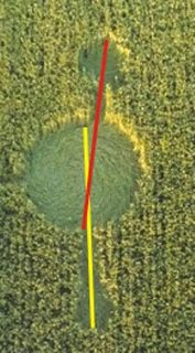
The formation reflects the opposition of Neptune at the lunar south node and Jupiter at the north node. The opposition is not very accurate, which is also clear with a closer look at the formation:
Quoted in extract — 292 characters of 2,542. The whole document is on the page that published it.
page text page text · ccc
author: Ken Heck (signature on the text) · date: 19 July 2016 (page navigation date) · language: en· 373 characters · source page
The poor construction of this crop circle suggests it is manmade. The center circle is a comet which has generated a fragment (a common occurrence). On the other side with the longer bar or line, the trajectory of the comet is indicated from its starting point. See Section 3 of my free ebook for similar examples at http://theheckhypothesis.com/aboutthebook.html
Ken Heck
Claims about this formation
24 claim(s) extracted by lexicon from the texts above, written by Kenneth Heck, Marc Smulders. A claim row is a record of what an author wrote, with the sentence verbatim. It is not evidence about the formation, and nothing here is tested on this page.
| claim type | reported as | claims | testable with this archive? | author(s) |
|---|---|---|---|---|
| calendar | calendar | 3 | testable | Marc Smulders |
| astronomical | astronomical | 16 | testable | Kenneth Heck, Marc Smulders |
| prediction | predictions | 2 | testable for dated claims | Marc Smulders |
| authorship_human | authorship | 1 | not_testable | Kenneth Heck |
| landscape | landscape | 2 | partly | Marc Smulders |
Up to 3 quote(s) per type, verbatim from the document:
- “In this respect, it is very notable that a similar solar eclipse occurred at the same lunar node 5766 years ago in the year 3751 BC (on June 19, proleptic Gregorian calendar).” calendar · Marc Smulders · source page
- “On the day of the formation this was also 50 × 9 × 13 tun (a tun = 360 days) as well as 90 × 90 Tzolkin-cycles ago (difference 8 days).” calendar · Marc Smulders · source page
- “It refers to the beginning of history, approximately the year 1 of the Hebrew calendar (5776 years ago) and connects this with a turning point in history short after the annular eclipse of September 1, this year.” calendar · Marc Smulders · source page
- “Mark the annular eclipse of September 1, it closes the circle that started some 5770 years ago.” astronomical · Marc Smulders · source page
- “The formation reflects the opposition of Neptune at the lunar south node and Jupiter at the north node.” astronomical · Marc Smulders · source page
- “On July 8, the date of the formation, the moon set conjunct Jupiter at the north node.” astronomical · Marc Smulders · source page
- “It possibly even predicts the end of history in the way we know it.” prediction · Marc Smulders · source page
- “The crop circle formation tells us that the circle, which started some 5770 years ago, will close soon after the annular eclipse of September 1 and has a close relationship with the crop circle formation at Stonehenge, which appeared on the very same day and also relates to 3751 BC.” prediction · Marc Smulders · source page
- “The poor construction of this crop circle suggests it is manmade.” authorship_human · Kenneth Heck · source page
- “The location at the Long Barrow shows a close relationship with the very past.” landscape · Marc Smulders · source page
- “The Long Barrow predates Stonehenge: the construction started about 3600 BC.” landscape · Marc Smulders · source page
Geometry
2 diagram file(s) on this page. measured from the diagram itself, and experimental: the extractor's rotational order is right on 88.8 % of a 200-diagram hand-labelled set against a gate of 90 %, so read a number here beside the picture rather than instead of it.
| diagram | rotational symmetry | elements | rings | mirror | fill |
|---|---|---|---|---|---|
| cc 5dba499e | ≈ none found | 1 | 1 | 0.94 | 0.2332 |
Experimental, and marked ≈ wherever it appears. These numbers are read off a drawing, not off the field: the extractor's rotational order agrees with a hand-labelled set on 88.8 per cent of 200 diagrams against a gate of 90 per cent, its element count is within one on 97.5 per cent, and its ring count is not calibrated at all. Nothing in the analysis tree is derived from the rotational order while that gate is unmet.
Diagrams that look like these: cc 5dba499e— the nearest by perceptual hash. The whole archive is browsable by shape in the shape section, and this formation's own diagrams go straight into that grid: show them in the grid.
Neighbours
In time
- previous
- Stonehenge 7 July 2016, Stonehenge
- next
- Twyford 11 July 2016, Twyford
- previous in UK
- Stonehenge 7 July 2016
- next in UK
- Twyford 11 July 2016
- same day
- Stanton Bridge (Stanton Bridge)
- within 7 days and 25 km
- Wilton Windmill 15 July 2016, 18.3 km away, 7 day(s) apart
In place
The nearest formations the archive can place.
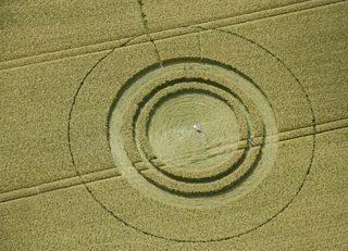 West Kennett22 June 2014
West Kennett
141 m away, 2014-06-22
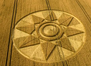 West Kennett28 July 2016
West Kennett
360 m away, 2016-07-28
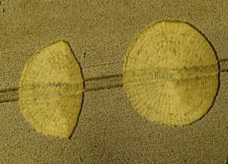 East Kennett6 August 2014
East Kennett
508 m away, 2014-08-06
 Silbury Hill15 July 1988
Silbury Hill
899 m away, 1988-07-15
 Silbury Hill26 July 1988
Silbury Hill
899 m away, 1988-07-26
 Silbury Hill30 July 1988
Silbury Hill
899 m away, 1988-07-30
- same county and year
- Hill Barn 6 May 2016 · Alton Barnes 11 May 2016 · Avebury 16 May 2016 · Silbury Hill 28 May 2016 · Willoughboy Hedge 5 June 2016 · Castle Hill 6 June 2016 · Wylye 16 June 2016 · Hackpen Hill 23 June 2016 · Stourton 29 June 2016 · Stanton Bridge 8 July 2016 · Stonehenge 7 July 2016 · Wilton Windmill 15 July 2016 · Devizes 16 July 2016 · Hackpen Hill 16 July 2016 · Burderop Down 20 July 2016 · Alton Barnes 22 July 2016 · Figsbury Rings 22 July 2016 · Ranscomb Bottom 23 July 2016 · All Cannings 22 July 2016 · West Kennett 28 July 2016 and 8 more
Provenance
- entity built at
- 2026-09-11T19:20:39Z (derived from the link decisions, not from this build)
- index run ids
- 20260911T192039Z-index-build
- reviews applied
- none
- open queue pairs
- none
- entity record
- index/formations/UK20160708_C.json · row in index/manifest.jsonl
- input digests
- entity 44bc24ca6167 · images 5727637b3857 · texts a086289f959a · geo 201a78ebfe81