Skip to the content
cropcircles
.
photos
the public record of crop formations, 1590–2026
view
Guide
Gallery
Seasons
Places
Crops
Shapes
Photographers
Writers
all places
England
Places · England · 12 formations
Cheshire
England
20 km
12 of the 12 formations listed here carry a coordinate. A solid dot is a fix to a place or better; a hollow one is known only as precisely as a county or a country, so several of them may be the same point.
2010s
1 formation
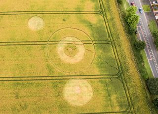
photograph
Steven Samosa
Widnes
7 July 2016 · England
UK20160707_A
7 July 2016 · England
photograph
· Steven Samosa
1990s
6 formations
3
May 1998
Chester
size not recorded
oilseed rape
Chester
3 May 1998 · England
UK19980503_A
3 May 1998 · England
21
July 1994
Chester
size not recorded
crop not recorded
Chester
21 July 1994 · England
UK19940721_B
21 July 1994 · England
13
July 1990
Waverton
size not recorded
crop not recorded
Waverton
13 July 1990 · England
UK19900713_B
13 July 1990 · England
2
July 1990
Lower Peover
98 ft across
crop not recorded
Lower Peover
2 July 1990 · England
UK19900702_A
2 July 1990 · England
drawing
cropcirclecenter.com / Bertold Zugelder
Lower Peover
26 June 1990 · England
UK19900626_A
26 June 1990 · England
drawing
· drawn by cropcirclecenter.com / Bertold Zugelder
1990
year only
Harefiedl
size not recorded
crop not recorded
Harefiedl
1990 · England
UK19901333_M
1990 · England
1980s
5 formations
17
June 1989
Lymm
size not recorded
crop not recorded
Lymm
17 June 1989 · England
UK19890617_B
17 June 1989 · England
1988
June 1988
Marple
size not recorded
crop not recorded
Marple
June 1988 · England
UK19880632_A
June 1988 · England
1987
year only
Chester
99 ft across
crop not recorded
Chester
1987 · England
UK19871333_D
1987 · England
1981
year only
Chester
size not recorded
crop not recorded
Chester
1981 · England
UK19811333_B
1981 · England
1981
year only
Chester
size not recorded
crop not recorded
Chester
1981 · England
UK19811333_A
1981 · England