Longwood Road
x-lp-7756284d5b755 August 2012·Longwood Road, Hampshire
Possibly the same formation as: these cross-site pairs are still open in the index review queue.
-
Owlesbury (Hampshire)(cc, tier C, score 0.60, rule county_only, pair 7e820345)
date 2012-08-05 vs 2012-08-05 (delta +0 d); county Hampshire == Hampshire; country UK (cc_id) == UK (uk_county)
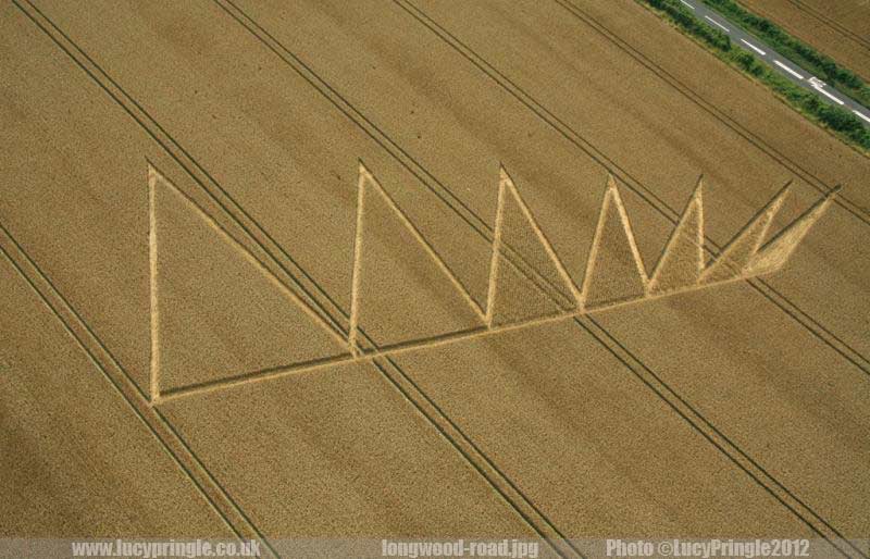
Reported 5 August 2012 at Longwood Road, Hampshire. One archive recorded it, so nothing about it can be cross-checked.
The record
- date
- 5 August 2012 (day precision)
- place
- Longwood Road
Hampshire
United Kingdom - crop
- not recorded by any source
- size
- not recorded
- recorded by
- lp
- images
- 1 on the record, 2 attached · 1 other
- writing
- nothing was written about this formation on any source
Also called
Longwood Road, nr Owslebury
Canonical name from the place of the index entity; the rest are what the other source records print for the same formation.
Where exactly
No coordinate could be resolved from any member record's place name.
Images
1 image(s) on this formation's own source records, and 2 more on 2 attached record(s) below. Click a tile for the full image; the bytes are fetched when you ask for them and are not stored in this page.
Photographs (1)
| site | kind | credit | basis | caption | size | file | source page |
|---|---|---|---|---|---|---|---|
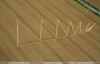
| lp | other | Lucy Pringle | page credit | A line of standing triangles of decreasing size. | 800×514 61.9 KiB image/jpeg |
image 630c1b891080 | https://www.cropcirclephotographs.co.uk/photos/2012/longwood-road-cropcircle-2012.shtml |
Attached photographs (2)
inferred link These pictures did not come with a source record of this formation. Each one is a single-photograph archive entry whose own date and place the index matched to this formation; nothing about the formation itself comes from them. The rule, the score and the evidence are printed with each record so the link can be checked, and the credit stays with the photograph.
Longwood Rd near Owslebury, Hampshire | 5th August 2012 | Wheat OH
tt temporarytemples.co.uk · archive_image · 5 August 2012 ·
matched on date and place by the index (not confirmed by hand) · rule attach, tier B, score 0.90 ·
pair 2f6f6739a661 · decided 2026-09-15T21:14:17Z
- attachment: tt archive_image longwood-rd-near-owslebury-hampshire-5th-august-2012-wheat-oh
- date 2012-08-05 vs 2012-08-05 (delta +0 d)
- name tokens shared: longwood
- place tokens shared: owslebury
- county Hampshire == Hampshire
- country UK (uk_county) == UK (uk_county)
- the only entity the photograph's date and place fit (x-lp-7756284d5b75)
| site | kind | credit | basis | caption | size | file | source page |
|---|---|---|---|---|---|---|---|
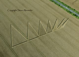
| tt | aerial | Steve Alexander / Temporary Temples | site default | Longwood Rd near Owslebury, Hampshire | 5th August 2012 | Wheat OH | 800×577 651.4 KiB image/jpeg |
image b5aefe9c89c8 | https://temporarytemples.co.uk/crop-circles/2012-crop-circles |
Longwood Rd near Owslebury, Hampshire | 5th August 2012 | Wheat L
tt temporarytemples.co.uk · archive_image · 5 August 2012 ·
matched on date and place by the index (not confirmed by hand) · rule attach, tier B, score 0.90 ·
pair c6004272782e · decided 2026-09-15T21:14:17Z
- attachment: tt archive_image longwood-rd-near-owslebury-hampshire-5th-august-2012-wheat-l
- date 2012-08-05 vs 2012-08-05 (delta +0 d)
- name tokens shared: longwood
- place tokens shared: owslebury
- county Hampshire == Hampshire
- country UK (uk_county) == UK (uk_county)
- the only entity the photograph's date and place fit (x-lp-7756284d5b75)
| site | kind | credit | basis | caption | size | file | source page |
|---|---|---|---|---|---|---|---|
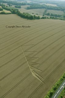
| tt | aerial | Steve Alexander / Temporary Temples | site default | Longwood Rd near Owslebury, Hampshire | 5th August 2012 | Wheat L | 533×800 430.1 KiB image/jpeg |
image 7484f80484d0 | https://temporarytemples.co.uk/crop-circles/2012-crop-circles |
Date
5 August 2012, to day precision. What a source records is the day a formation was found and reported.
- reported by
- lp: 5 August 2012
- weekday
- Sunday, day 218 of the year, ISO week 31, summer
- sun and moon
- 45.5 days after the June solstice; moon waning gibbous (87% lit), 3.4 days after the full moon (computed at 12:00 UTC; a reported date is a discovery date, not a creation date)
Place
What each source printed, and the coordinate derived from it. No source in this archive publishes a coordinate of its own.
| site | place | county | country | grid ref | what3words | fix |
|---|---|---|---|---|---|---|
| lp | Longwood Road, nr Owslebury | Hampshire | none |
Crop and size
crop and size not recorded by any source
Source records
What each source published, side by side. A row whose values differ across the sources is marked: the archive prints the disagreement rather than choosing a winner.
| field | lp cropcirclephotographs.co.uk |
|---|---|
| id / slug | longwood-road-2012 |
| name | Longwood Road |
| location | Longwood Road, nr Owslebury |
| county | Hampshire |
| country | |
| date reported | 2012-08-05 |
| date precision | day |
| crop | |
| size | |
| diameter (ft) | |
| grid reference | |
| what3words | |
| map link | |
| credits | Lucy Pringle |
| source page | https://www.cropcirclephotographs.co.uk/photos/2012/longwood-road-cropcircle-2012.shtml |
| link to the entity | singleton decided by none on 2026-09-15 |
| warnings | none |
| record | lp/7756284d5b757… raw record view: /formation/lp/7756284d5b757184500a22b98c1b4068e62f418abe86e79a7b0c385dc4a0a484 in the preview app |
Texts
no text documents in the archive for this formation
Claims about this formation
no claim was extracted from a text about this formation
Geometry
no diagram of this formation has been measured
0 diagram file(s) on this page. no diagram of this formation has been measured; run `python -m scraper analysis geometry` to fill this section.
Neighbours
In time
- previous
- Pickford 4 August 2012, Pickford
- next
- Bíly kámen 7 August 2012, Bíly kámen
- previous in UK
- Pickford 4 August 2012
- next in UK
- Cheesefoot Head 9 August 2012
- same day
- Milk Hill (Milk Hill) · Owlesbury (Owlesbury)
- within 7 days and 25 km
- none, or this formation has no coordinate at place confidence or better
In place
The nearest formations the archive can place.
this formation has no coordinate at place confidence or better, so nothing can be called near it
- same county and year
- Chilcomb Down 1 July 2012 · Longwood Warren 23 July 2012 · Owlesbury 29 July 2012 · Owlesbury 5 August 2012 · Cheesefoot Head 9 August 2012 · Cheesefoot Head 9 August 2012 · Cheesefoot Head (1) 9 August 2012 · Cheesefoot Head (2) 9 August 2012 · Owslebury 29 July 2012
Provenance
- entity built at
- 2026-09-15T21:14:17Z (derived from the link decisions, not from this build)
- index run ids
- 20260915T211417Z-index-build
- reviews applied
- none
- open queue pairs
- 7e8203458fb0e41db21535f3551336714e383f6289c9c0759e25dc362b0a2844
- entity record
- index/formations/x-lp-7756284d5b75.json · row in index/manifest.jsonl
- input digests
- entity f1654ba24fc2 · images 4885169daa5b · attachments 9e3d87e1fc0a · texts 4f53cda18c2b · geo none