cropcircles.photos the public record of crop formations, 1590–2026
view

Crop · 3,016 formations · page 9 of 32

wheat

Newest first. A crop is what a source printed beside a formation, folded to one name; the hue beside it is a label from the site's own crop table and never a measurement.

2000s

96 formations
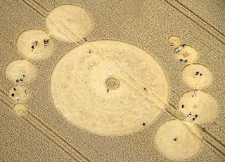
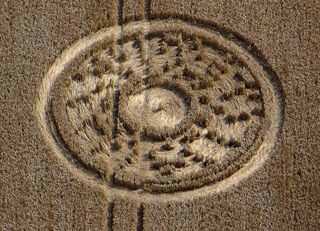
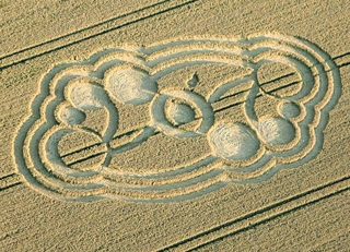
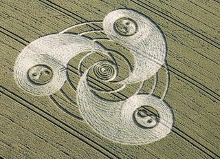
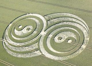
aerial of Silbury Hill photograph
Olivier MorelSilbury Hill3 August 2009 · EnglandUK20090803_C 3 August 2009 · England photograph · Olivier Morel
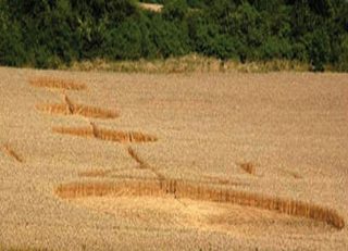
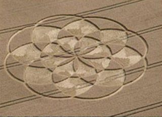
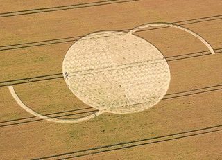
aerial of Rollright Stones photograph
Frank LaumenRollright Stones3 August 2009 · EnglandUK20090803_B 3 August 2009 · England photograph · Frank Laumen
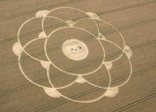
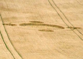
aerial of Cross Dyke photograph
anonymousCross Dyke3 August 2009 · EnglandUK20090803_A 3 August 2009 · England photograph · anonymous
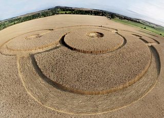
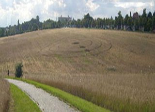
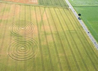
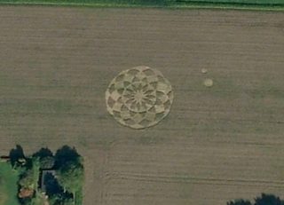
aerial of Olomouc photograph
Google EarthOlomouc3 August 2009 · Czech RepublicCZ20090803_A 3 August 2009 · Czech Republic photograph · Google Earth
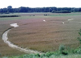
aerial of Morgans Hill photograph
Lucy PringleMorgans Hill2 August 2009 · EnglandUK20090802_B 2 August 2009 · England photograph · Lucy Pringle
aerial of Alton Priors photograph
Russel StannardAlton Priors2 August 2009 · EnglandUK20090802_A 2 August 2009 · England photograph · Russel Stannard
aerial of Illschwang photograph
Norbert WeisIllschwang2 August 2009 · GermanyDE20090802_A 2 August 2009 · Germany photograph · Norbert Weis
diagram of Cervene Pecky drawing
cropcirclecenter.com / Bertold ZugelderCervene Pecky1 August 2009 · Czech RepublicCZ20090801_A 1 August 2009 · Czech Republic drawing · drawn by cropcirclecenter.com / Bertold Zugelder
aerial of Winterbourne Bassett photograph
Lucy PringleWinterbourne Bassett31 July 2009 · EnglandUK20090731_C 31 July 2009 · England photograph · Lucy Pringle
aerial of Waden Hill photograph
cropcirclecenter.comWaden Hill31 July 2009 · EnglandUK20090731_B 31 July 2009 · England photograph · cropcirclecenter.com
aerial of Hackpen Hill photograph
Olivier MorelHackpen Hill31 July 2009 · EnglandUK20090731_A 31 July 2009 · England photograph · Olivier Morel
aerial of Standdaarbuiten photograph
Sjaak DamenStanddaarbuiten31 July 2009 · The NetherlandsNL20090731_A 31 July 2009 · The Netherlands photograph · Sjaak Damen
aerial of Ogbourne St Andrew photograph
Lucy PringleOgbourne St Andrew29 July 2009 · EnglandUK20090729_A 29 July 2009 · England photograph · Lucy Pringle
aerial of Winterbourne Bassett photograph
Lucy PringleWinterbourne Bassett28 July 2009 · EnglandUK20090728_A 28 July 2009 · England photograph · Lucy Pringle
aerial of Hübenthal photograph
Harald Hoos (?)Hübenthal26 July 2009 · GermanyDE20090726_A 26 July 2009 · Germany photograph · Harald Hoos (?)
aerial of Berg photograph
Beni Siedler, vogel-perspektive.chBerg26 July 2009 · SwitzerlandsCH20090726_A 26 July 2009 · Switzerlands photograph · Beni Siedler, vogel-perspektive.ch
diagram of Tawesmead Copse drawing
cropcirclecenter.com / Bertold ZugelderTawesmead Copse25 July 2009 · EnglandUK20090725_B 25 July 2009 · England drawing · drawn by cropcirclecenter.com / Bertold Zugelder
aerial of Alton Priors photograph
Russel StannardAlton Priors25 July 2009 · EnglandUK20090725_A 25 July 2009 · England photograph · Russel Stannard
aerial of Ogbourne Down photograph
Lucy PringleOgbourne Down24 July 2009 · EnglandUK20090724_A 24 July 2009 · England photograph · Lucy Pringle
aerial of Ridderkerk photograph
Peter VanlaerhovenRidderkerk24 July 2009 · The NetherlandsNL20090724_A 24 July 2009 · The Netherlands photograph · Peter Vanlaerhoven
aerial of Herange-en-Moselle photograph
cerclesdanslanuit.comHerange-en-Moselle23 July 2009 · FranceFR20090723_A 23 July 2009 · France photograph · cerclesdanslanuit.com
aerial of Meensen photograph
Stefan Rampfel, www.goeflug.deMeensen23 July 2009 · GermanyDE20090723_A 23 July 2009 · Germany photograph · Stefan Rampfel, www.goeflug.de
aerial of Woodborough Hill photograph
Lucy PringleWoodborough Hill22 July 2009 · EnglandUK20090722_A 22 July 2009 · England photograph · Lucy Pringle
aerial of Martinsell Hill photograph
Steve AlexanderMartinsell Hill19 July 2009 · EnglandUK20090719_B 19 July 2009 · England photograph · Steve Alexander
aerial of Liddington Castle photograph
Lucy PringleLiddington Castle19 July 2009 · EnglandUK20090719_A 19 July 2009 · England photograph · Lucy Pringle
aerial of Burg Pleese photograph
Stefan Rampfel, www.goeflug.deBurg Pleese19 July 2009 · GermanyDE20090719_B 19 July 2009 · Germany photograph · Stefan Rampfel, www.goeflug.de
aerial of Berlin Mahlsdorf photograph
G. Grinda, D. LoslebenBerlin Mahlsdorf19 July 2009 · GermanyDE20090719_A 19 July 2009 · Germany photograph · G. Grinda, D. Losleben
aerial of Stryszawa photograph
anonymousStryszawa17 July 2009 · PolandPL20090717_A 17 July 2009 · Poland photograph · anonymous
aerial of Kaltenhof photograph
Benjamin SerbeKaltenhof17 July 2009 · GermanyDE20090717_A 17 July 2009 · Germany photograph · Benjamin Serbe
aerial of Wolbrechtshausen photograph
Lutz Fiedler, www.luftbild-eichsfeld.deWolbrechtshausen16 July 2009 · GermanyDE20090716_A 16 July 2009 · Germany photograph · Lutz Fiedler, www.luftbild-eichsfeld.de
aerial of Wilbur photograph
NBC affiliate, KHQ, channel 6Wilbur14 July 2009 · United StatesUS20090714_A 14 July 2009 · United States photograph · NBC affiliate, KHQ, channel 6
aerial of Hinton Admiral photograph
Gary Ellson – Bournemouth HelicoptersHinton Admiral14 July 2009 · EnglandUK20090714_C 14 July 2009 · England photograph · Gary Ellson – Bournemouth Helicopters
aerial of Grey Wethers photograph
Lucy PringleGrey Wethers14 July 2009 · EnglandUK20090714_B 14 July 2009 · England photograph · Lucy Pringle
aerial of Alton Barnes photograph
Lucy PringleAlton Barnes14 July 2009 · EnglandUK20090714_A 14 July 2009 · England photograph · Lucy Pringle
aerial of Chilcomb Down photograph
Lucy PringleChilcomb Down13 July 2009 · EnglandUK20090713_B 13 July 2009 · England photograph · Lucy Pringle
diagram of All Cannings drawing
cropcirclecenter.com / Bertold ZugelderAll Cannings13 July 2009 · EnglandUK20090713_A 13 July 2009 · England drawing · drawn by cropcirclecenter.com / Bertold Zugelder
diagram of Hluboka drawing
cropcirclecenter.com / Bertold ZugelderHluboka13 July 2009 · Czech RepublicCZ20090713_A 13 July 2009 · Czech Republic drawing · drawn by cropcirclecenter.com / Bertold Zugelder
aerial of Barterode photograph
Stefan Rampfel, www.goeflug.deBarterode12 July 2009 · GermanyDE20090712_A 12 July 2009 · Germany photograph · Stefan Rampfel, www.goeflug.de
aerial of Hörhausen photograph
Benni Siedler, www.vogel-perspektive.chHörhausen12 July 2009 · SwitzerlandCH20090712_A 12 July 2009 · Switzerland photograph · Benni Siedler, www.vogel-perspektive.ch
aerial of Radford Hill photograph
Lucy PringleRadford Hill11 July 2009 · EnglandUK20090711_A 11 July 2009 · England photograph · Lucy Pringle
aerial of Kozarovce photograph
anonymousKozarovce11 July 2009 · SlovakiaSK20090711_A 11 July 2009 · Slovakia photograph · anonymous
aerial of All Cannings photograph
Steve AlexanderAll Cannings10 July 2009 · EnglandUK20090710_A 10 July 2009 · England photograph · Steve Alexander
aerial of Standdaarbuiten photograph
Richard van RijswijkStanddaarbuiten10 July 2009 · The NetherlandsNL20090710_A 10 July 2009 · The Netherlands photograph · Richard van Rijswijk
diagram of Litavou drawing
cropcirclecenter.com / Bertold ZugelderLitavou10 July 2009 · Czech RepublicCZ20090710_A 10 July 2009 · Czech Republic drawing · drawn by cropcirclecenter.com / Bertold Zugelder
aerial of Chesterton photograph
Lucy PringleChesterton9 July 2009 · EnglandUK20090709_A 9 July 2009 · England photograph · Lucy Pringle
aerial of Yatesbury photograph
Lucy PringleYatesbury8 July 2009 · EnglandUK20090708_A 8 July 2009 · England photograph · Lucy Pringle
aerial of Standdaarbuiten photograph
RandellStanddaarbuiten7 July 2009 · The NetherlandsNL20090707_A 7 July 2009 · The Netherlands photograph · Randell
diagram of Honeystreet drawing
cropcirclecenter.com / Bertold ZugelderHoneystreet6 July 2009 · EnglandUK20090706_A 6 July 2009 · England drawing · drawn by cropcirclecenter.com / Bertold Zugelder
aerial of Stanton St Bernard photograph
Lucy PringleStanton St Bernard5 July 2009 · EnglandUK20090705_C 5 July 2009 · England photograph · Lucy Pringle
aerial of Silbury Hill photograph
Lucy PringleSilbury Hill5 July 2009 · EnglandUK20090705_B 5 July 2009 · England photograph · Lucy Pringle
aerial of Devizes photograph
Jack RoderickDevizes5 July 2009 · EnglandUK20090705_A 5 July 2009 · England photograph · Jack Roderick
aerial of Pfaffenhofen photograph
Thomas SteiningerPfaffenhofen5 July 2009 · GermanyDE20090705_A 5 July 2009 · Germany photograph · Thomas Steininger
aerial of Freloux photograph
RenaudFreloux5 July 2009 · BelgiumBE20090705_A 5 July 2009 · Belgium photograph · Renaud
aerial of Pewsey photograph
Charles R. MallettPewsey4 July 2009 · EnglandUK20090704_B 4 July 2009 · England photograph · Charles R. Mallett
aerial of Beckhampton photograph
John MontgomeryBeckhampton4 July 2009 · EnglandUK20090704_A 4 July 2009 · England photograph · John Montgomery
diagram of Waden Hill drawing
cropcirclecenter.com / Bertold ZugelderWaden Hill3 July 2009 · EnglandUK20090703_A 3 July 2009 · England drawing · drawn by cropcirclecenter.com / Bertold Zugelder
aerial of Milk Hill photograph
John MontgomeryMilk Hill2 July 2009 · EnglandUK20090702_A 2 July 2009 · England photograph · John Montgomery
aerial of Bezdez photograph
UFO Club ZábleskBezdez2 July 2009 · Czech RepublicCZ20090702_A 2 July 2009 · Czech Republic photograph · UFO Club Záblesk
aerial of Momalle photograph
RenaudMomalle2 July 2009 · BelgiumBE20090702_A 2 July 2009 · Belgium photograph · Renaud
aerial of Waden Hill photograph
Lucy PringleWaden Hill1 July 2009 · EnglandUK20090701_A 1 July 2009 · England photograph · Lucy Pringle
aerial of Standdaarbuiten photograph
RandellStanddaarbuiten1 July 2009 · The NetherlandsNL20090701_A 1 July 2009 · The Netherlands photograph · Randell
aerial of Kessel-Lo photograph
Google EarthKessel-LoJuly 2009 · BelgiumBE20090733_C July 2009 · Belgium photograph · Google Earth
aerial of Kessel-Lo photograph
Google EarthKessel-LoJuly 2009 · BelgiumBE20090733_B July 2009 · Belgium photograph · Google Earth
aerial of Aalst photograph
Google EarthAalstJuly 2009 · BelgiumBE20090733_A July 2009 · Belgium photograph · Google Earth
aerial of Momalle photograph
RenaudMomalle1 July 2009 · BelgiumBE20090701_A 1 July 2009 · Belgium photograph · Renaud
aerial of Pewsey White Horse photograph
Lucy PringlePewsey White Horse28 June 2009 · EnglandUK20090628_D 28 June 2009 · England photograph · Lucy Pringle
diagram of Milk Hill drawing
cropcirclecenter.com / Bertold ZugelderMilk Hill28 June 2009 · EnglandUK20090628_C 28 June 2009 · England drawing · drawn by cropcirclecenter.com / Bertold Zugelder
aerial of Beckhampton photograph
Steve AlexanderBeckhampton28 June 2009 · EnglandUK20090628_A 28 June 2009 · England photograph · Steve Alexander
aerial of Milk Hill photograph
John MontgomeryMilk Hill27 June 2009 · EnglandUK20090627_C 27 June 2009 · England photograph · John Montgomery
aerial of Honeystreet photograph
Jack RoderickHoneystreet27 June 2009 · EnglandUK20090627_B 27 June 2009 · England photograph · Jack Roderick
aerial of Alton Priors photograph
John MontgomeryAlton Priors27 June 2009 · EnglandUK20090627_A 27 June 2009 · England photograph · John Montgomery
aerial of Martinsell Hill photograph
John MontgomeryMartinsell Hill25 June 2009 · EnglandUK20090625_A 25 June 2009 · England photograph · John Montgomery
aerial of Winterbourne Bassett photograph
Russel StannardWinterbourne Bassett24 June 2009 · EnglandUK20090624_A 24 June 2009 · England photograph · Russel Stannard
aerial of Milk Hill photograph
Lucy PringleMilk Hill23 June 2009 · EnglandUK20090623_A 23 June 2009 · England photograph · Lucy Pringle
aerial of Vidalengo photograph
anonymousVidalengo23 June 2009 · ItalyIT20090623_A 23 June 2009 · Italy photograph · anonymous
aerial of Rochford Golf Course photograph
Wayland SothcottRochford Golf Course22 June 2009 · EnglandUK20090622_B 22 June 2009 · England photograph · Wayland Sothcott
diagram of Milk Hill drawing
cropcirclecenter.com / Bertold ZugelderMilk Hill22 June 2009 · EnglandUK20090622_A 22 June 2009 · England drawing · drawn by cropcirclecenter.com / Bertold Zugelder
aerial of West Kennett photograph
Lucy PringleWest Kennett21 June 2009 · EnglandUK20090621_B 21 June 2009 · England photograph · Lucy Pringle
aerial of Milk Hill photograph
Annemieke WitteveenMilk Hill21 June 2009 · EnglandUK20090621_A 21 June 2009 · England photograph · Annemieke Witteveen
aerial of Waden Hill photograph
Steve AmorWaden Hill20 June 2009 · EnglandUK20090620_A 20 June 2009 · England photograph · Steve Amor
diagram of West Kennett drawing
cropcirclecenter.com / Bertold ZugelderWest Kennett19 June 2009 · EnglandUK20090619_A 19 June 2009 · England drawing · drawn by cropcirclecenter.com / Bertold Zugelder
diagram of West Kennett drawing
cropcirclecenter.com / Bertold ZugelderWest Kennett17 June 2009 · EnglandUK20090617_A 17 June 2009 · England drawing · drawn by cropcirclecenter.com / Bertold Zugelder
aerial of Moie photograph
anonymousMoie17 June 2009 · ItalyIT20090617_A 17 June 2009 · Italy photograph · anonymous
aerial of West Kennett photograph
Kristi HalvorsonWest Kennett15 June 2009 · EnglandUK20090615_A 15 June 2009 · England photograph · Kristi Halvorson
aerial of Murska Sobota photograph
anonymousMurska Sobota15 June 2009 · SloveniaSI20090615_A 15 June 2009 · Slovenia photograph · anonymous
diagram of Verjux drawing
cropcirclecenter.com / Bertold ZugelderVerjux15 June 2009 · FranceFR20090615_A 15 June 2009 · France drawing · drawn by cropcirclecenter.com / Bertold Zugelder
aerial of Barbury Castle photograph
Lucy PringleBarbury Castle14 June 2009 · EnglandUK20090614_A 14 June 2009 · England photograph · Lucy Pringle
aerial of Tawesmead Copse photograph
Lucy PringleTawesmead Copse13 June 2009 · EnglandUK20090613_B 13 June 2009 · England photograph · Lucy Pringle
aerial of Monforte d'Alba photograph
trifaseMonforte d'Alba11 June 2009 · ItalyIT20090611_A 11 June 2009 · Italy photograph · trifase
aerial of Bourges photograph
elenachacha – youtubeBourges8 June 2009 · FranceFR20090608_A 8 June 2009 · France photograph · elenachacha – youtube
aerial of Monteiasi photograph
Space FreedomMonteiasi5 June 2009 · ItalyIT20090605_A 5 June 2009 · Italy photograph · Space Freedom
aerial of Brugherio photograph
Planetcircles.comBrugherio25 May 2009 · ItalyIT20090525_A 25 May 2009 · Italy photograph · Planetcircles.com
diagram of Sobradinho drawing
cropcirclecenter.com / Bertold ZugelderSobradinho20 November 2008 · BrazilBR20081120_A 20 November 2008 · Brazil drawing · drawn by cropcirclecenter.com / Bertold Zugelder
aerial of Formosa Do Sul photograph
anonymousFormosa Do Sul19 November 2008 · BrazilBR20081119_B 19 November 2008 · Brazil photograph · anonymous
diagram of Faxinal Dos Guedes drawing
cropcirclecenter.com / Bertold ZugelderFaxinal Dos Guedes19 November 2008 · BrazilBR20081119_A 19 November 2008 · Brazil drawing · drawn by cropcirclecenter.com / Bertold Zugelder
aerial of Ouro Verde photograph
anonymousOuro Verde16 November 2008 · BrazilBR20081116_A 16 November 2008 · Brazil photograph · anonymous